


Table of Contents
- How Aerial Roof Measurement Technology Works
- Accuracy of Aerial vs. Manual Measurements
- Factors Affecting Aerial Roof Quote Precision
- Aerial Roof Measurement Software Accuracy: What the Data Shows
- How to Verify a Roof Replacement Quote Properly
- When to Trust Aerial Quotes and When to Demand a Site Survey
- Conclusion
Last Updated: August 7, 2026
How Aerial Roof Measurement Technology Works
Aerial roof measurement technology relies on two primary methodologies: photogrammetry and satellite imagery. Both capture data from above, eliminating the need for contractors to physically access the roof during initial assessment. Understanding how these systems work is essential to evaluating whether are aerial roof quotes really accurate for your specific situation.
Photogrammetry and AI-Driven Modeling
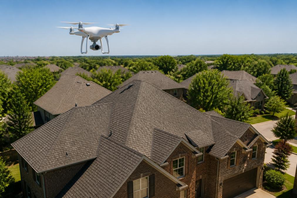
Photogrammetry extracts precise measurements from digital photographs. When a drone hovers above your home, it captures overlapping images from multiple angles. AI-driven modeling software analyzes these images to create a three-dimensional model of your roof’s geometry, identifying roof planes, calculating pitch angles, and measuring eave lengths with accuracy rivaling ground-based methods.
Machine learning algorithms detect roof edges, distinguish between materials, and account for perspective distortion. This automation allows contractors to generate estimates within hours. However, accuracy depends heavily on image quality, lighting conditions, and the software’s ability to recognize your specific roof type.
Photogrammetry’s strength lies in consistency. The same aerial data processed through the same software produces identical results, which is why insurance adjusters increasingly accept aerial roof quotes as preliminary documentation for supplemental claims.
Satellite Imagery and Remote Sensing
Satellite-based roof reports use publicly available or proprietary satellite imagery combined with remote sensing technology. These systems don’t require a drone visit. Instead, they analyze existing satellite data to estimate roof dimensions and material composition. Modern satellite imagery has improved dramatically, but it remains coarser than drone-based photogrammetry.
Remote sensing infers roof characteristics by analyzing how different materials reflect light. Asphalt shingles, metal roofing, and tile each have distinct spectral signatures. This approach works reasonably well for simple, uniform roofs but struggles with complex geometries, mixed materials, or heavily shaded areas.
The major limitation is that satellite imagery cannot detect details smaller than a few feet. A satellite system might accurately estimate overall square footage but miss dormers, skylights, or complex valleys that significantly impact labor costs and material requirements. This is where manual vs aerial roof inspection comparisons become critical, satellite data alone often underestimates complexity.
Accuracy of Aerial vs. Manual Measurements
Whether are aerial roof quotes really accurate cannot be answered with a simple yes or no. Accuracy depends on what you’re measuring, how complex your roof is, and which method you’re comparing against.
Geometric Accuracy and Margin of Error
Photogrammetry-based aerial quotes typically achieve geometric accuracy within 2-5% when measuring roof planes and linear dimensions. If your actual roof is 2,000 square feet, an aerial estimate might calculate 1,960 to 2,050 square feet. For most roofing projects, this margin is acceptable because material waste factors and labor estimates already include buffers.
However, geometric accuracy and quote accuracy are not the same. A quote is accurate only if the final bill matches the estimate. Many aerial quotes underestimate total cost because they miss complexity factors that only ground-based inspection reveals.
Manual measurements by experienced contractors tend to be slightly more precise for complex roofs but introduce human variability. Photogrammetry eliminates this human factor, making it more consistent, though not necessarily more accurate for every situation.
Material Estimation Challenges
Identifying roofing materials from above is harder than it appears. Photogrammetry software can distinguish between broad categories, asphalt shingles versus metal versus tile, but struggles with nuance. Different shingle colors and styles appear identical from 100 feet up. Weathering, algae growth, or moss coverage can skew the AI’s assessment of material condition.
Satellite imagery performs even worse at material identification. A satellite system might correctly identify asphalt shingles but cannot determine specific grade, thickness, or warranty level. This leads to material estimation challenges that inflate or deflate quotes significantly.
Insurance adjusters understand this limitation. When filing supplemental claims, they often require ground-based inspection to verify material type and confirm that aerial assessment didn’t misidentify your roofing system.
Factors Affecting Aerial Roof Quote Precision
Several environmental and structural factors determine whether an aerial quote will be reliable or misleading.
Environmental Limitations and Weather Conditions
Cloud cover obscures roof details and confuses the photogrammetry algorithm. Rain, snow, or moisture on the roof surface creates reflections that distort measurements. Contractors typically capture imagery on clear, dry days, meaning seasonal timing affects data quality.
Trees surrounding your home create another challenge. Overhanging branches obscure portions of the roof, forcing software to estimate hidden areas. Large trees also cast shadows that distort measurements.
Time of day matters too. Early morning or late afternoon sun creates long shadows that exaggerate roof slopes. Midday overhead sun produces the clearest imagery but is available for only a few hours per day. The best aerial data comes from clear days with moderate sun angles.
Roof Complexity and Slope Detection
Simple roofs with gentle slopes and few interruptions are ideal for accurate aerial measurement. A basic gable roof on a ranch home will yield highly reliable data. Steep roofs, dormers, skylights, chimneys, and complex valley intersections create challenges.
Slope detection depends on clear, unobstructed imagery. A 45-degree pitch roof is easier to measure than a 30-degree pitch. Shallow-pitch roofs, particularly flat or low-slope commercial roofs, are notoriously difficult for photogrammetry. Valleys and intersections where two roof planes meet create ambiguity. Small errors in identifying these edges compound across the entire measurement. A roof with multiple valleys, dormers, and intersecting planes may have 8-12% margin of error rather than the typical 2-5%.
Aerial Roof Measurement Software Accuracy: What the Data Shows
Different software platforms produce different results when analyzing the same aerial imagery. This inconsistency reveals an important truth: the software itself is a variable in the accuracy equation.
Spatial Resolution and Data Verification
Spatial resolution refers to how much detail imagery captures. A drone flying at 200 feet altitude captures finer detail than a satellite 400 miles above earth. Most drone-based photogrammetry achieves 1-2 centimeter spatial resolution, sufficient to detect roof planes and measure linear dimensions accurately.
Data verification reveals that most aerial measurement platforms achieve 90-95% accuracy for square footage estimates on simple roofs. The remaining error typically comes from edge detection failures, slope measurement errors, or software misinterpretation of roof geometry.
However, these accuracy percentages are measured against other aerial data or simplified lab conditions. Comparisons to actual installed materials show larger discrepancies. A roof estimated at 2,000 square feet might actually require 2,150 square feet of material after accounting for waste, overlaps, and edge conditions the software didn’t capture.
Common Pitfalls in Roof Measurement Reports
The most common pitfall is failing to account for roof overhang and eave length. Software measures the roof surface itself but may underestimate actual material needed to cover overhangs and complete edge details. A 6-inch overhang missed on all sides of a 2,000-square-foot roof adds 150-200 square feet of material.
Another frequent error is misidentifying roof penetrations. Chimneys, vents, and skylights must be subtracted from total square footage. If the software fails to detect these features or miscalculates their size, the quote becomes inaccurate.
Slope detection errors are also common, particularly on transitional roof sections. Where a steep section meets a shallow section, the software may average the angles rather than measuring each plane separately.
Lastly, aerial reports often fail to identify hidden damage or structural issues. A roof may appear intact from above while harboring rot, missing sheathing, or structural damage underneath.
Aerial quotes that come in significantly lower than competing bids should trigger a red flag. The contractor may be using incomplete aerial data or deliberately underestimating to win the job.
How to Verify a Roof Replacement Quote Properly
The question of how to verify a roof replacement quote properly is not about choosing between aerial and manual methods, it’s about using both strategically.
Requesting a Defensible Estimate
A defensible estimate is backed by clear documentation and accounts for known complexity factors. When requesting an aerial quote, ask the contractor to provide a detailed measurement report showing calculations for each roof plane, the software platform used, and the date imagery was captured. Request photos from the aerial survey and review them yourself to spot details the software might have missed.
Ask the contractor to specify the margin of error in their estimate. A reputable contractor will acknowledge limitations and indicate which areas require ground verification.
Ground-Based Inspection Validation
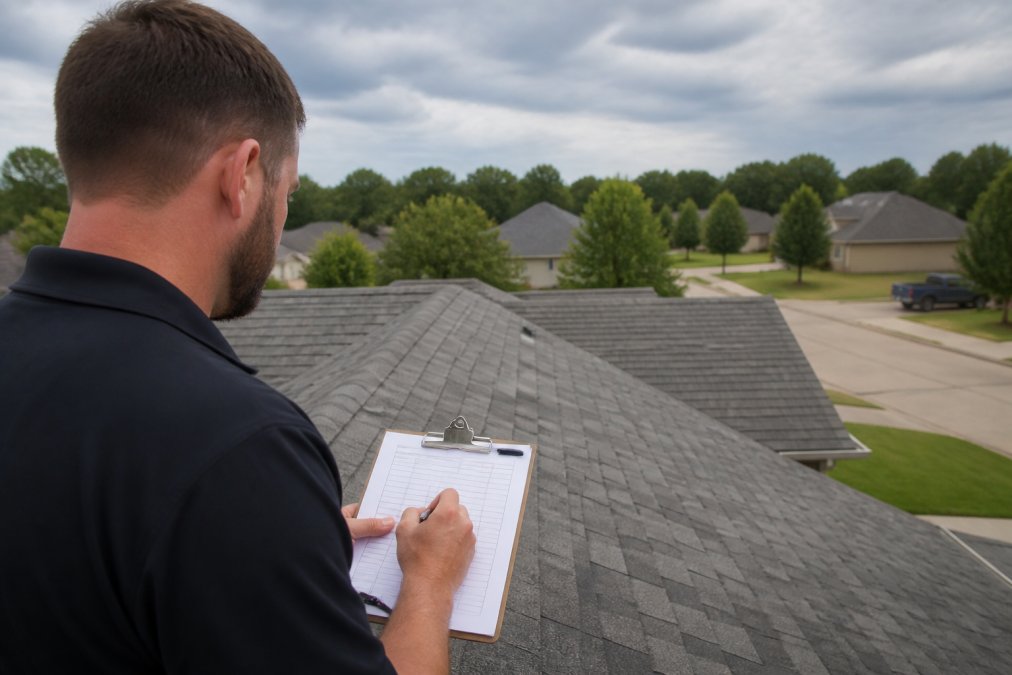
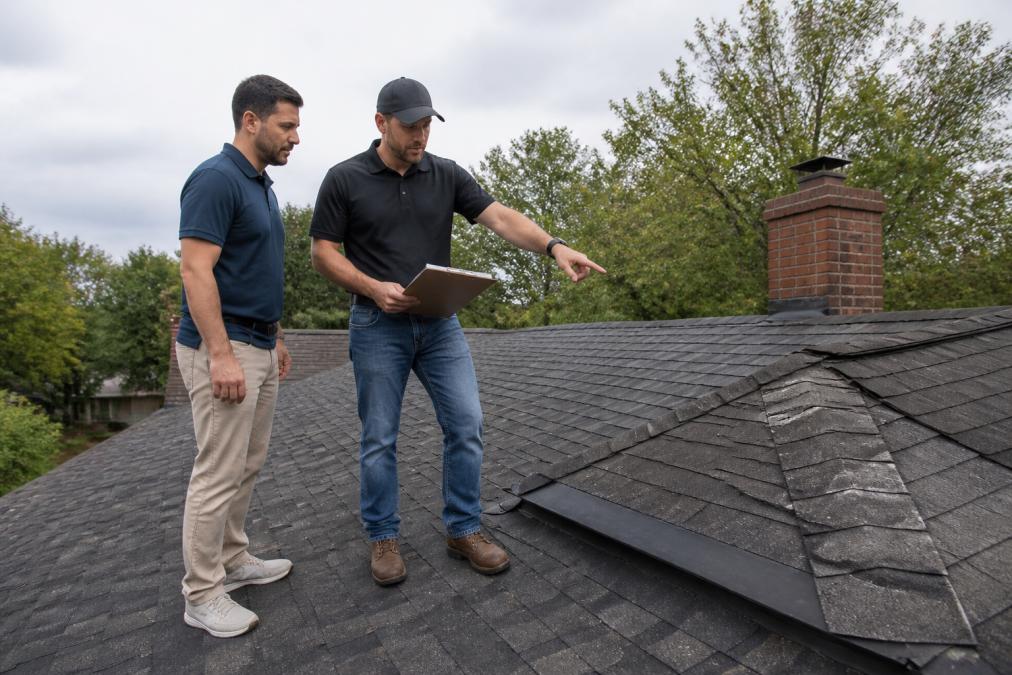
The most reliable approach combines aerial measurement with a physical site survey. A ground-based inspection allows the contractor to verify aerial data, identify hidden damage, and confirm material type and condition.
During a ground inspection, the contractor should measure key dimensions independently using traditional tools. These measurements should align closely with aerial data. If they diverge by more than 5%, the aerial data may be unreliable for that section.
The inspector should photograph the roof from ground level, documenting material condition, existing damage, and areas where aerial imagery was obscured. A thorough ground inspection takes 1-2 hours for a typical residential roof and transforms the aerial quote into a more defensible number.
Request both an aerial-only quote and a quote based on combined aerial plus ground inspection. The difference reveals how much the aerial data missed.
When to Trust Aerial Quotes and When to Demand a Site Survey
Not every roof situation warrants the expense of a ground-based inspection. Understanding when aerial data is sufficient helps you make cost-effective decisions.
Simple Roof Geometry vs. Complex Designs
Trust aerial quotes for simple roof geometry. A single-story ranch home with a basic gable or hip roof, minimal penetrations, and clear visibility from above is ideal for aerial measurement. If your roof has fewer than three planes, no dormers or skylights, and straightforward overhangs, an aerial quote should be reliable within 3-5%.
Demand a ground-based inspection for complex designs. Multi-story homes with multiple roof sections, dormers, skylights, chimneys, and valley intersections require physical verification. A roof with more than six distinct planes or significant slope variations should be measured from the ground. Flat or low-slope commercial roofs should always include ground verification.
The cost of a ground inspection is typically $200-500 for residential properties. For small repairs on simple roofs, you may skip the ground visit. For larger projects, the inspection cost represents a smaller percentage and is easier to justify.
Insurance Claims and Legal Standing
Insurance adjusters increasingly accept aerial roof quotes as preliminary documentation, but they often require ground verification before approving payment for supplemental work. If you’re filing a storm damage claim, an aerial quote alone may not be sufficient to justify the claim amount.
The legal standing of aerial quotes varies by insurance company and claim type. Before investing in an aerial quote, contact your insurance company and ask what documentation they require for your specific claim.
For warranty and liability purposes, a ground-based inspection creates a paper trail. If the contractor later discovers damage during the project that wasn’t documented in the initial quote, an inspection report protects both parties.
Rescue Roofing assists with insurance claim filing and communicates directly with adjusters on your behalf. This support is particularly valuable when aerial quotes need to be verified or when additional documentation is required to justify supplemental claims.
The accuracy of aerial roof quotes depends entirely on how you use them. For straightforward assessments of simple roofs, aerial measurement technology delivers reliable data. For complex roofing situations, insurance claims, or projects where precision directly impacts your bottom line, combine aerial data with a ground-based inspection.
Rescue Roofing uses aerial measurement as a starting point, not a final answer. Our team verifies aerial data with physical site surveys, communicates directly with insurance adjusters, and provides transparent quotes that account for measurement limitations. When you work with us, you’re getting professional guidance on whether an estimate is trustworthy for your specific situation. Learn more about roof measurement standards from the National Roofing Contractors Association. Contact Rescue Roofing today for an aerial assessment followed by ground verification, and let our team handle the insurance process so you can focus on protecting your property.
Frequently Asked Questions
How accurate is aerial imagery for roof measurements?
Aerial roof measurement technology typically achieves geometric accuracy within 5-10% for square footage calculations on simple roof geometries. However, accuracy depends heavily on spatial resolution, weather conditions at the time of capture, and roof complexity. Flat or gently sloped roofs with minimal obstructions produce more reliable estimates than complex designs with multiple planes, valleys, and dormers. For insurance claims or contractor bids, many professionals recommend pairing aerial data with ground-based inspection to verify material conditions and detect hidden damage that imagery cannot reveal.
What are the common limitations of satellite roof measurements?
Satellite-based roof reports struggle with several key limitations. Cloud cover and weather conditions can obscure imagery entirely. Spatial resolution may not capture fine details like missing shingles, flashing damage, or deterioration. Slope detection algorithms can misinterpret roof pitch on complex geometries with multiple planes. Satellite imagery also cannot assess material condition, age, or structural integrity, only dimensions. Additionally, trees, chimneys, and vents can obstruct measurement of certain roof sections. For these reasons, aerial estimates work best as a preliminary screening tool, not as a final defensible estimate for insurance claims.
When should I get a manual roof inspection instead of relying on an aerial quote?
Request a ground-based site survey if your roof has complex geometry, multiple valleys, or dormers; if you're filing an insurance claim and need a defensible estimate; if previous quotes vary significantly; or if you suspect hidden damage from storms or age. Aerial data alone cannot detect material deterioration, water damage under shingles, or structural issues. A manual inspection by a qualified contractor provides as-built dimensions, material assessment, and evidence for supplemental claims. For most homeowners, combining both methods, using aerial quotes for initial estimates and ground inspection for verification, provides the most reliable and defensible approach.
How do I know if a roof quote is accurate before work begins?
Verify a roof replacement quote by requesting detailed documentation of how measurements were obtained, whether aerial, manual, or both. Ask the contractor to specify square footage, material quantities, and labor scope separately. Compare multiple quotes using consistent measurement methods. For insurance claims, ensure the estimate includes data verification and references the specific roof planes measured. Request a site visit to confirm measurements match visible roof conditions. Be wary of quotes that differ dramatically from others, as this may indicate measurement errors. A professional contractor should be transparent about their measurement methodology and willing to explain how they calculated material needs and pricing.
This article was written using GrandRanker